- Home
- /
- Projects
Projects
The City of Mauldin has a number of exciting projects on the horizon that will enhance quality of life for residents and visitors alike. From dynamic mixed-use developments to new trails and critical road improvements, there’s a lot to look forward to in Mauldin. Explore the information below to get the latest details on our current projects.


Developments
Development in the city is centered around creating vibrant community hubs and mixed-use gathering spaces with diverse dining, entertainment and residential options, helping Mauldin transform from a crossroad community to a destination.
- Maverick Yards (City Center Village Phase I)
- City Center South (City Center Village Phase II)
- Stadium at BridgeWay Station
Project Overview
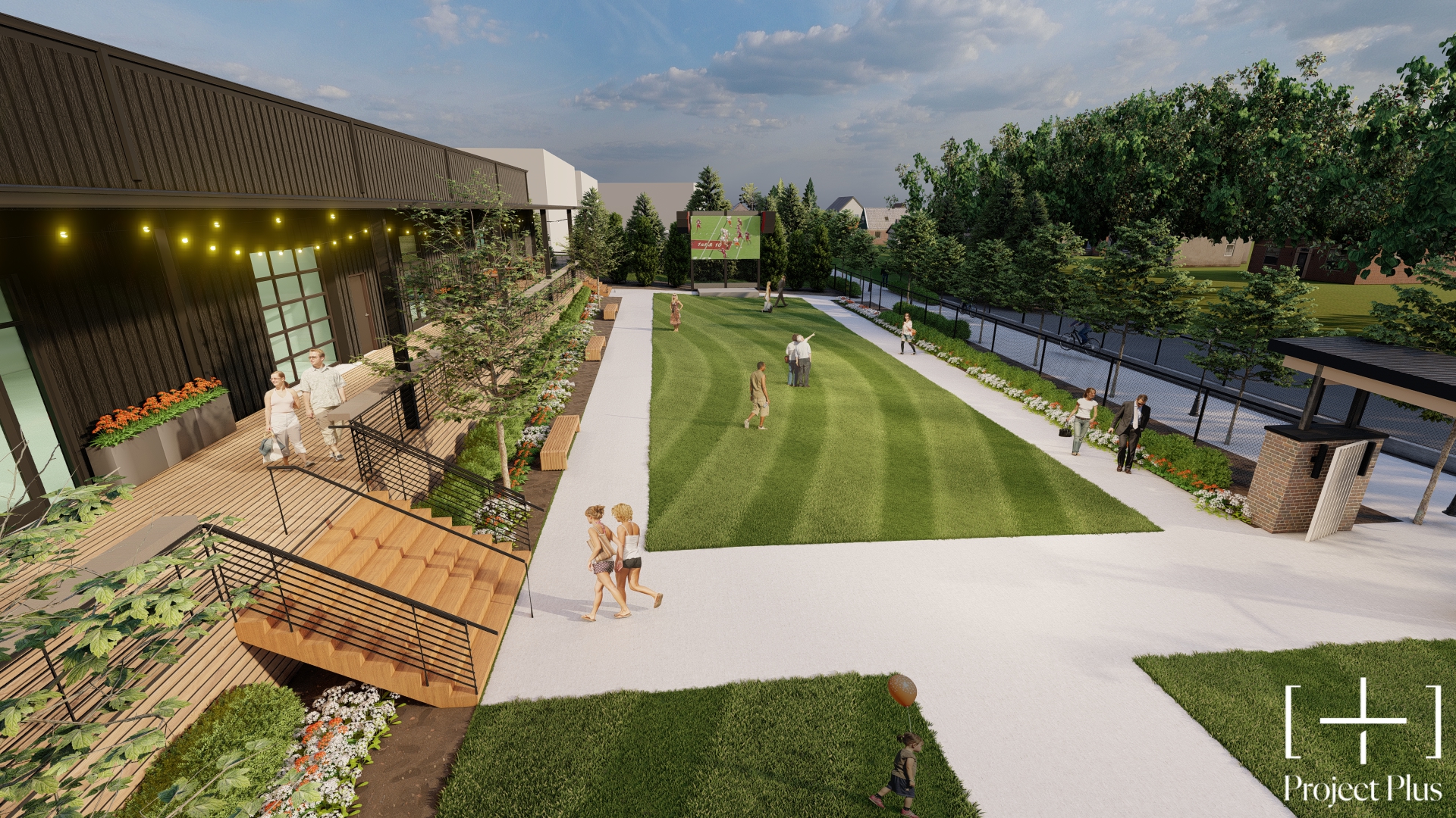
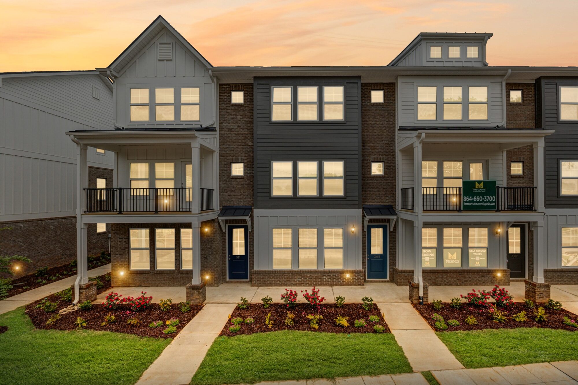
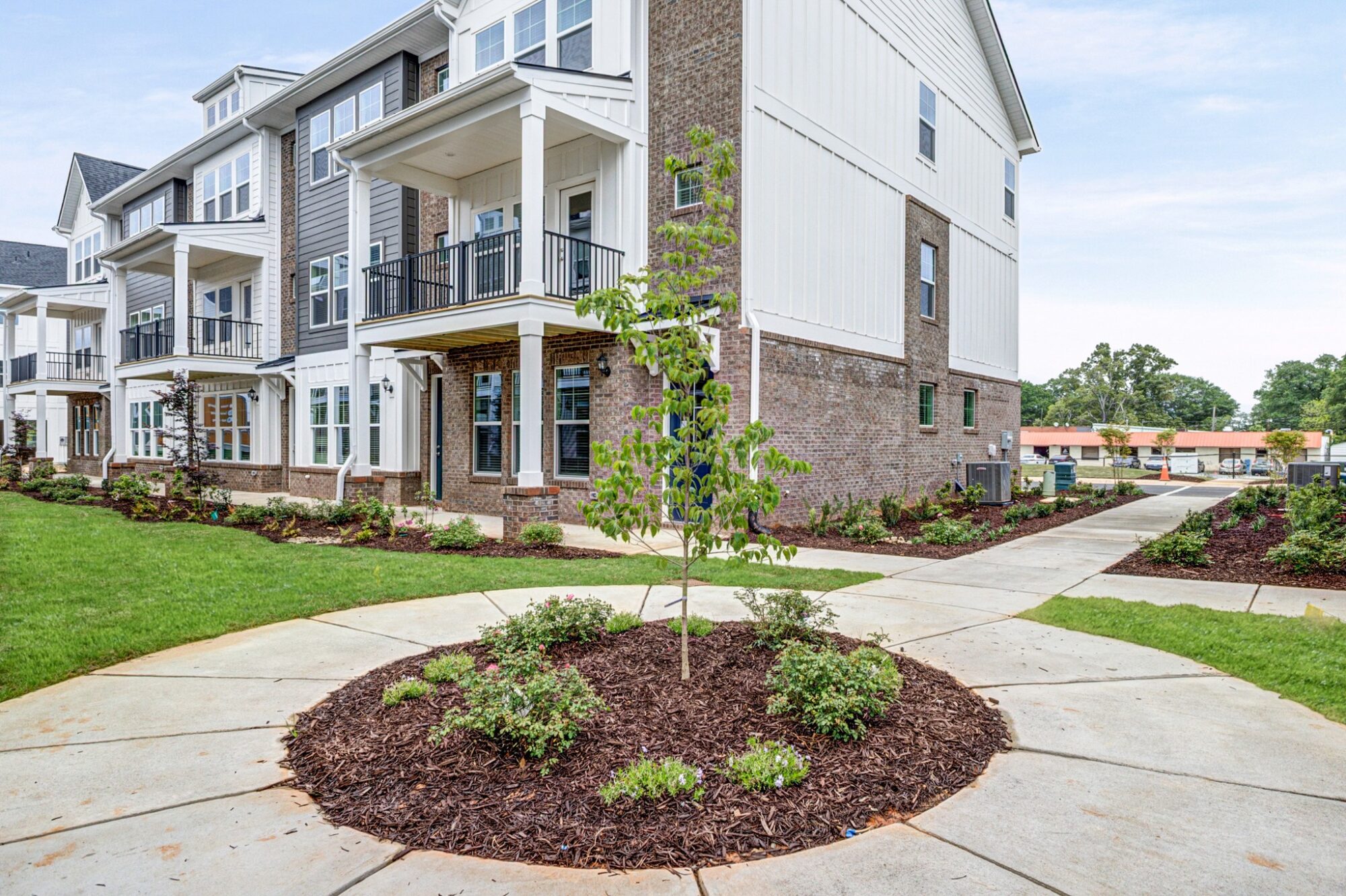
Maverick Yards is a mixed-use development that kicks off long-awaited City Center Village, an effort by the City of Mauldin and local property owners to create a walkable and livable downtown.
Located at the corner of Jenkins Street and Jenkins Court, Maverick Yards includes more than 40 townhomes for rent and an entertainment and dining complex, all with eventual access to the Swamp Rabbit Trail.
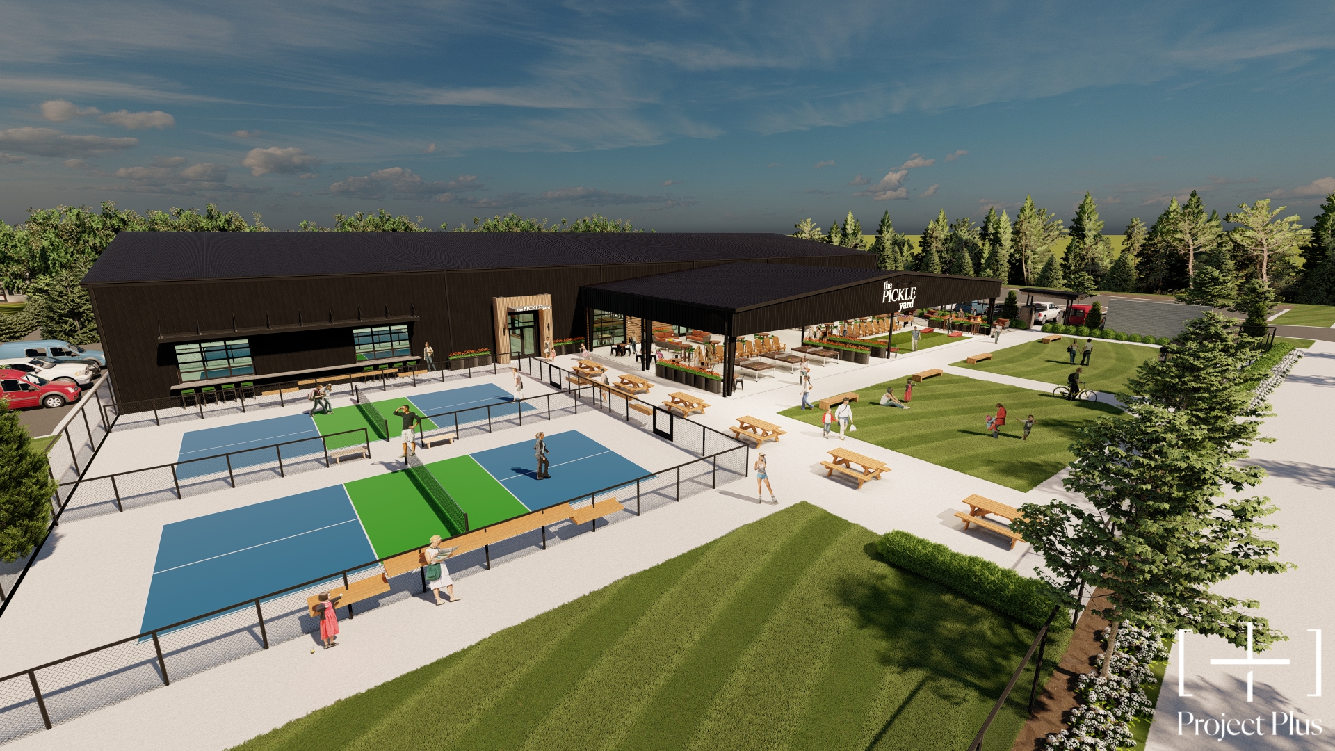
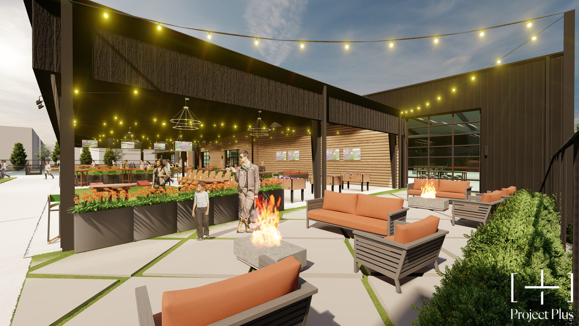
As the focal point of the project, the Parker Group is redeveloping a 20,000 square-foot industrial warehouse into “The Pickle Yard,” which will feature pickleball courts, multiple food concepts, a stage for live performances, outdoor seating, fire pits and a beer garden.

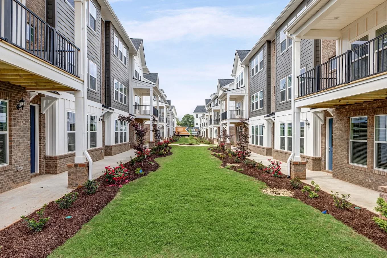
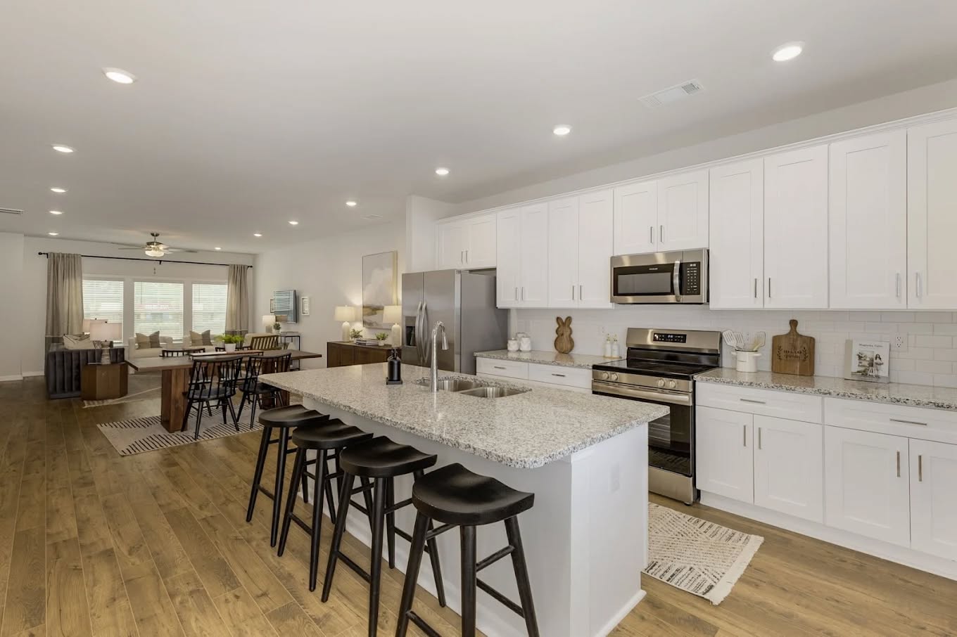
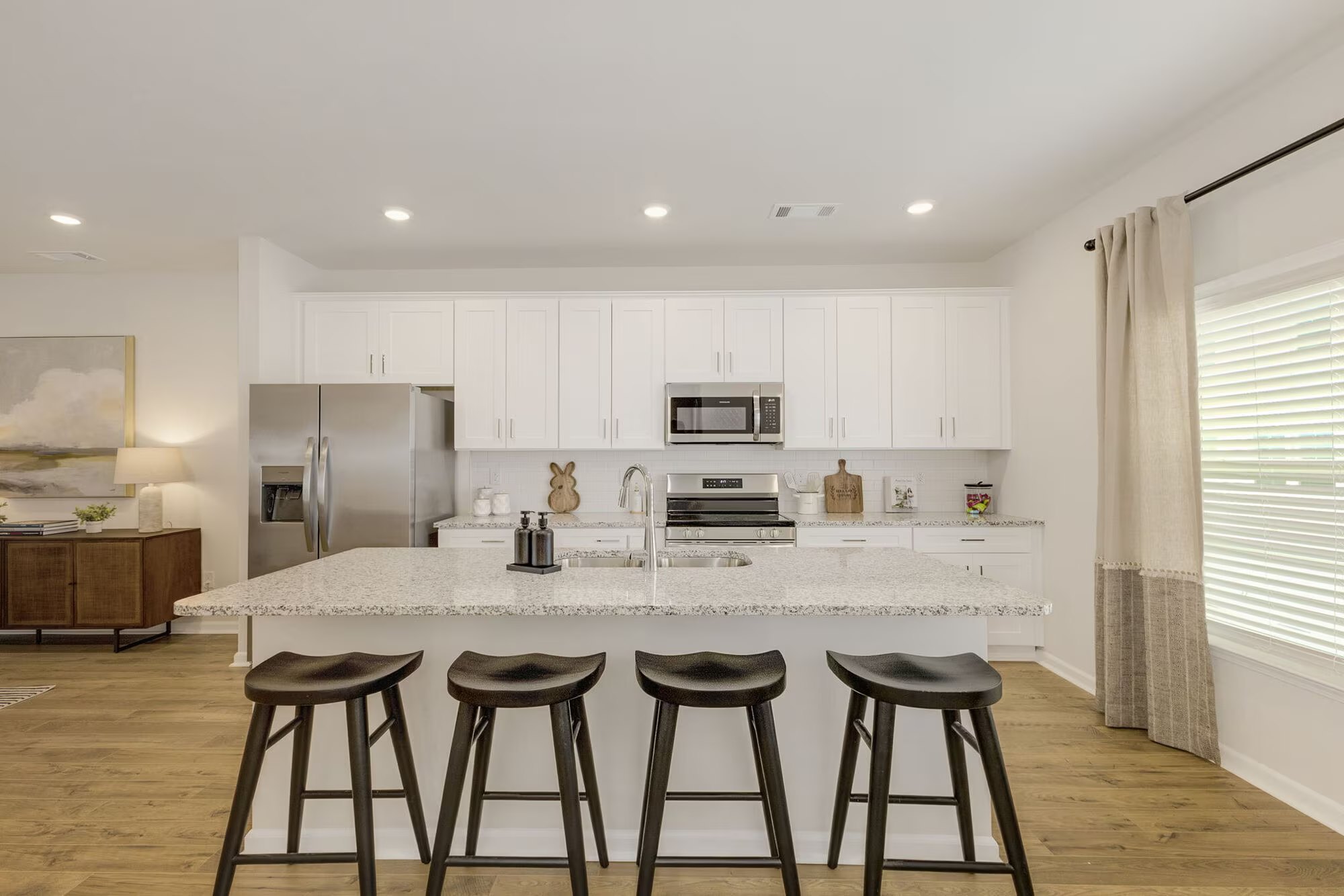
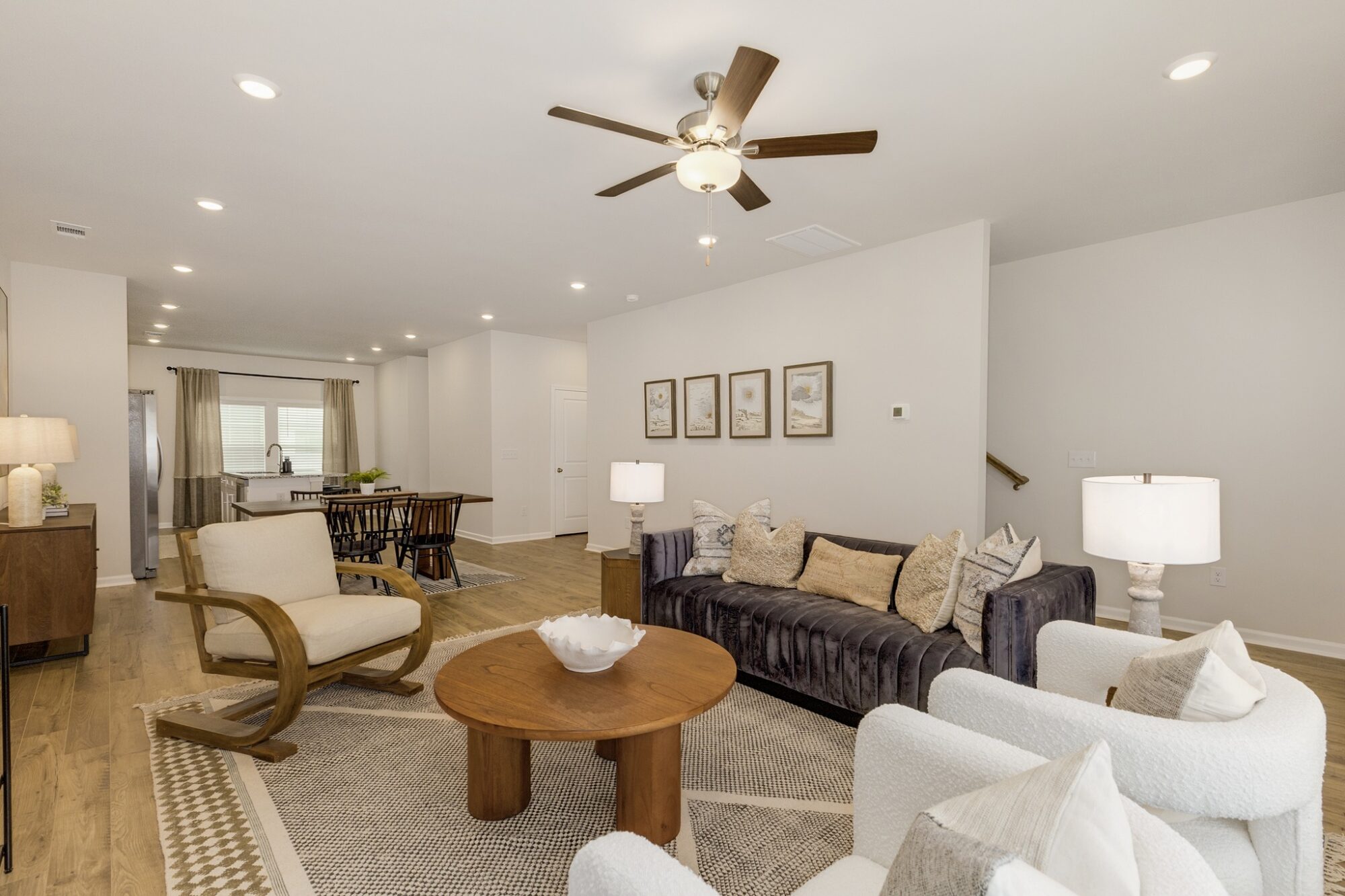
Adjacent to that complex, at the former site of the City’s Public Works facility and a light industrial building, Longbranch Development has redeveloped 2.4 acres of property into more than 40 townhomes available for rent. Known as The Courts at Maverick Yards, the townhomes feature three bedrooms, two-car garages and open floor plans.


Timeline
The project broke ground on June 12, 2023. Construction on the residential townhomes is complete, with units are available for rent, and The Pickle Yard opened in mid-December 2025.
For more information on Maverick Yards, visit cityofmauldin.org/maverick-yards.
Project Overview
City Center South is the second phase of City Center Village, an effort by City leaders to build an area in the heart of Mauldin that resembles a traditional downtown focused on walkability, defined spaces and an infusion of culture, commerce and community.
City Center South will complement the first phase of City Center Village, known as Maverick Yards, a mixed-use development featuring more than 40 townhomes available for rent and a dining and entertainment complex slated for completion in December 2025.
City Center South will extend to the area surrounding City Hall, featuring a mixed-use development that will connect people, businesses and visitors to a unique urban environment.
Timeline
In January 2025, the City completed a downtown master plan that identifies redevelopment opportunities on City-owned property surrounding City Hall, and officials are currently working with development partners to create plans for the area.
View the City Center Master Plan here.
Project Overview
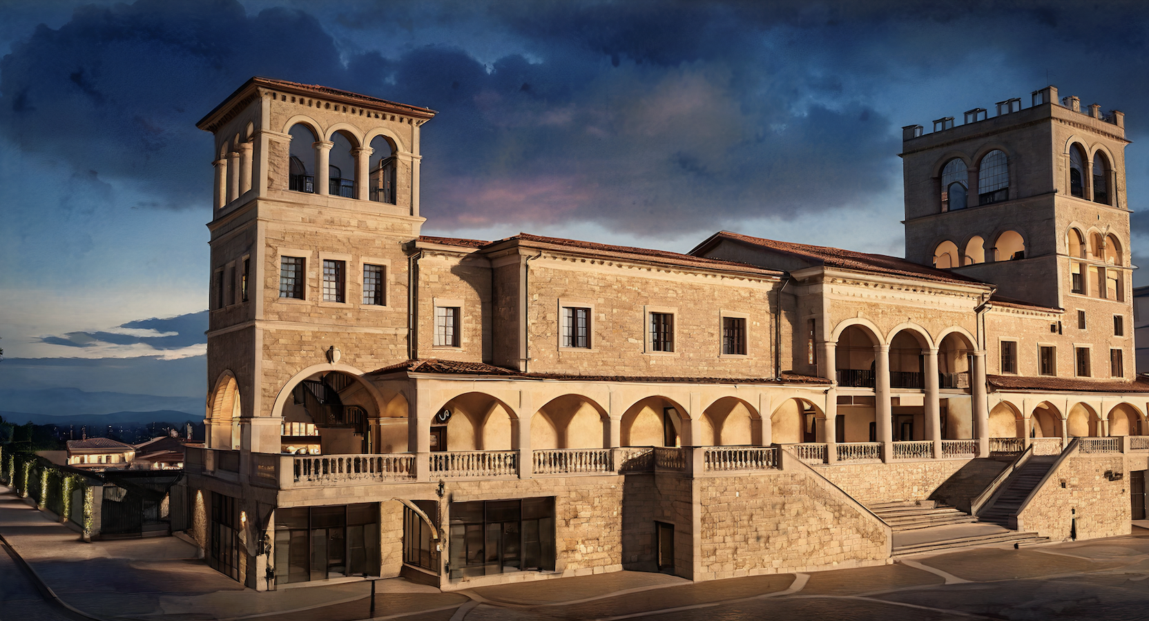
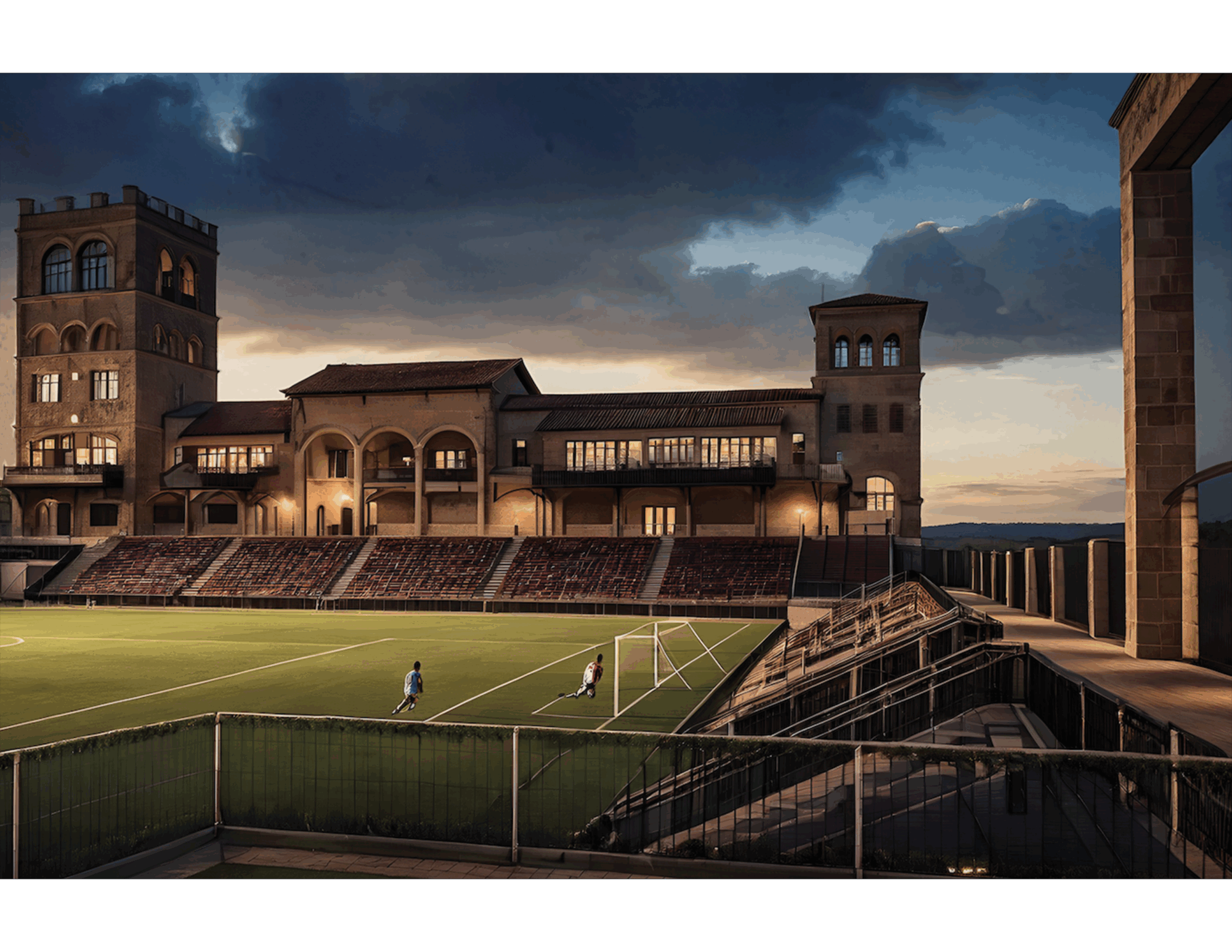
The City of Mauldin, Hughes Investments and the Greenville Triumph and Greenville Liberty soccer clubs have announced plans to build a multi-use sports and entertainment stadium at BridgeWay Station that will serve as the permanent home for the Triumph and Liberty.
The venue will also host professional and youth sports matches, concerts, festivals and community events.
The project is a public-private partnership, made possible through an investment of $4 million from the City of Mauldin, $10 million from the State of South Carolina, and more than $13.5 million from Greenville Pro Soccer (GPS), along with donated land and in-kind planning, development and coordination contributions from Hughes Investments, developer of BridgeWay Station.
The stadium will accommodate up to 6,300 people, including seating, standing room and suites. Revised from initial plans for 10,000 seats, the new design will create a more intimate experience for fans and ensure the stadium is the right fit for BridgeWay Station and the surrounding communities.
Construction & Design
Edifice Construction, one of the Southeast’s leading commercial builders, has been selected as general contractor, while Johnston Design Group is leading architectural design.
The design will mirror BridgeWay Station’s European-inspired architecture, featuring grand columns, ornamental cornices, Italian-inspired towers, and expansive archways that serve as grand entrances into the stadium.
Community Impact
The stadium will serve as both a cultural and economic driver, attracting visitors from across the region and creating new opportunities for local businesses. With its year-round programming, the venue will energize the local economy and help cement Mauldin’s position as one of the fastest-growing and most dynamic communities in South Carolina.
Timeline
On March 12, 2025, the City of Mauldin, Hughes Investments and Greenville Pro Soccer celebrated the stadium groundbreaking, featuring a special appearance by soccer legend and Greenville Triumph co-owner Ronaldinho, widely regarded as one of the greatest players of all time.


In August of 2025, crews from Edifice Construction mobilized and began construction. The stadium is slated to host its first match on June 3, 2026.
For more information on the stadium project, click here.
Road Improvements
Road improvements in the City of Mauldin are aimed at improving traffic flow, easing congestion and enhancing pedestrian-bicycle safety and access. Learn more about our road improvement projects below.
- Building a Better Butler (SCDOT)
- Jenkins Street Road Project
- Municipal Resurfacing Program (GLDTC)
- Ashmore Bridge / Standing Springs Interchange Improvements (GLDTC)
Project Overview
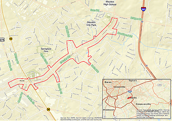
The Butler Road Improvements Project will improve a 1.7-mile section of E. Butler Rd from the Mauldin Senior Center entrance to US 276 (N. Main Street).
The project is designed to ease traffic congestion and enhance bicycle-pedestrian access by improving existing sidewalks along the corridor and adding a multiuse path that connects to existing paths at the Mauldin Cultural Center and Mauldin Senior Center. The project is also expected to increase connectivity to City Center Village, BridgeWay Station and eventually the Swamp Rabbit Trail.
The South Carolina Department of Transportation (SCDOT) is overseeing the project, in conjunction with the Greenville-Pickens Area Transportation Study (GPATS), the City of Mauldin, and the Federal Highway Administration (FHWA).
Project Details
The following are potential improvements to E. Butler Rd:
- Constructing curb and gutter, a sidewalk on one side, and a multiuse path on the other side of the roadway to tie into existing facilities
- Adding medians throughout the corridor
- Making intersection improvements at N. Main Street, Hyde Circle/Bon Air Street, Murray Drive/Fairfield Drive, Old Mill/Bethel Drive, and Brookbend Rd
- Replacing existing culverts with two bridges on E. Butler Rd over Gilder Creek
Timeline
As of August 2025, SCDOT and Duke Energy have secured the necessary right-of-ways. Utility relocations will begin in November 2025 and should take approximately 24 months to complete before moving to construction, which is estimated to take 18 to 24 months. As the City learns more about construction plans and timeline, we will share that info with the public.
For additional details, visit buildingabetterbutler.com.
Project Overview
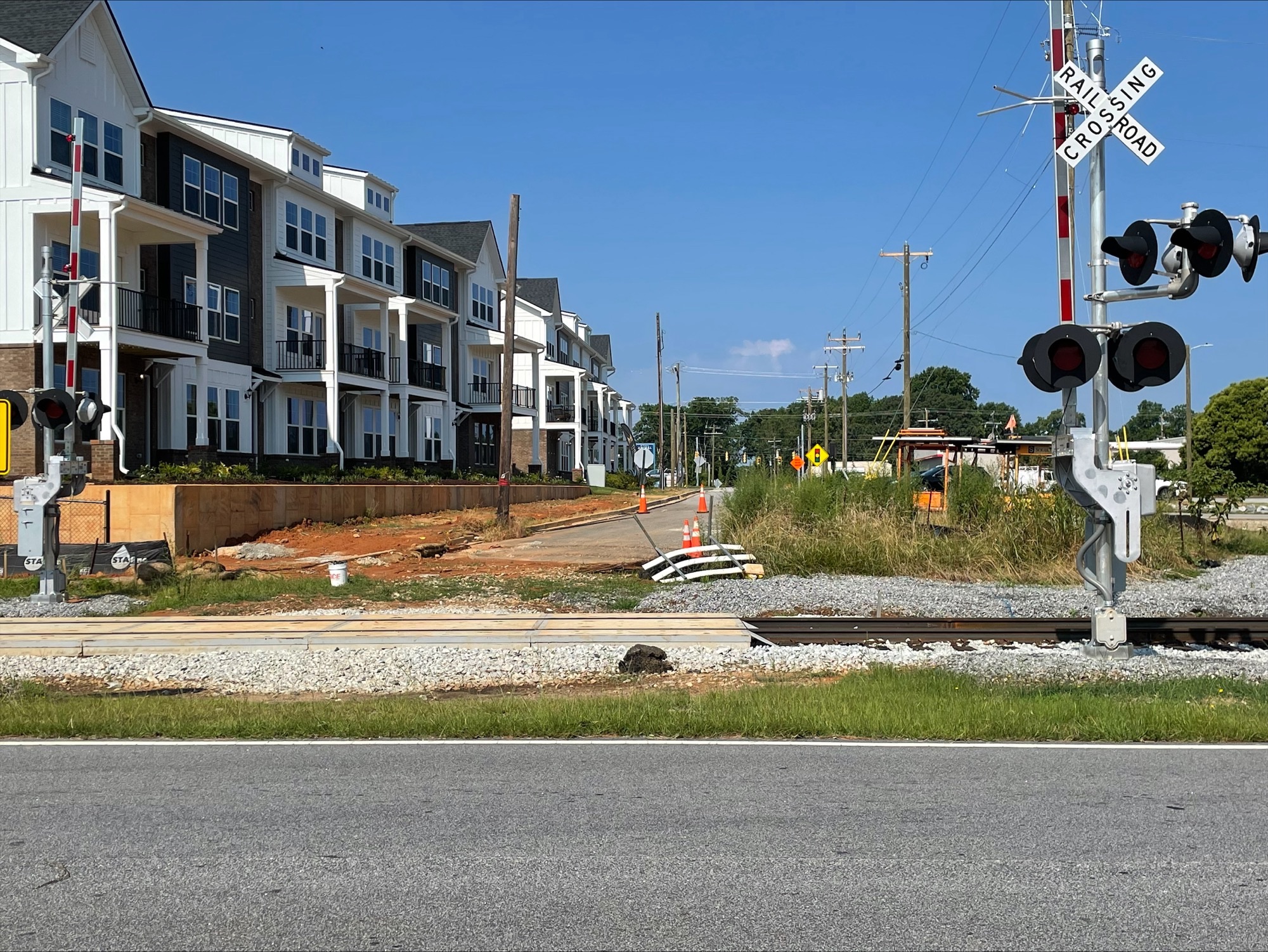
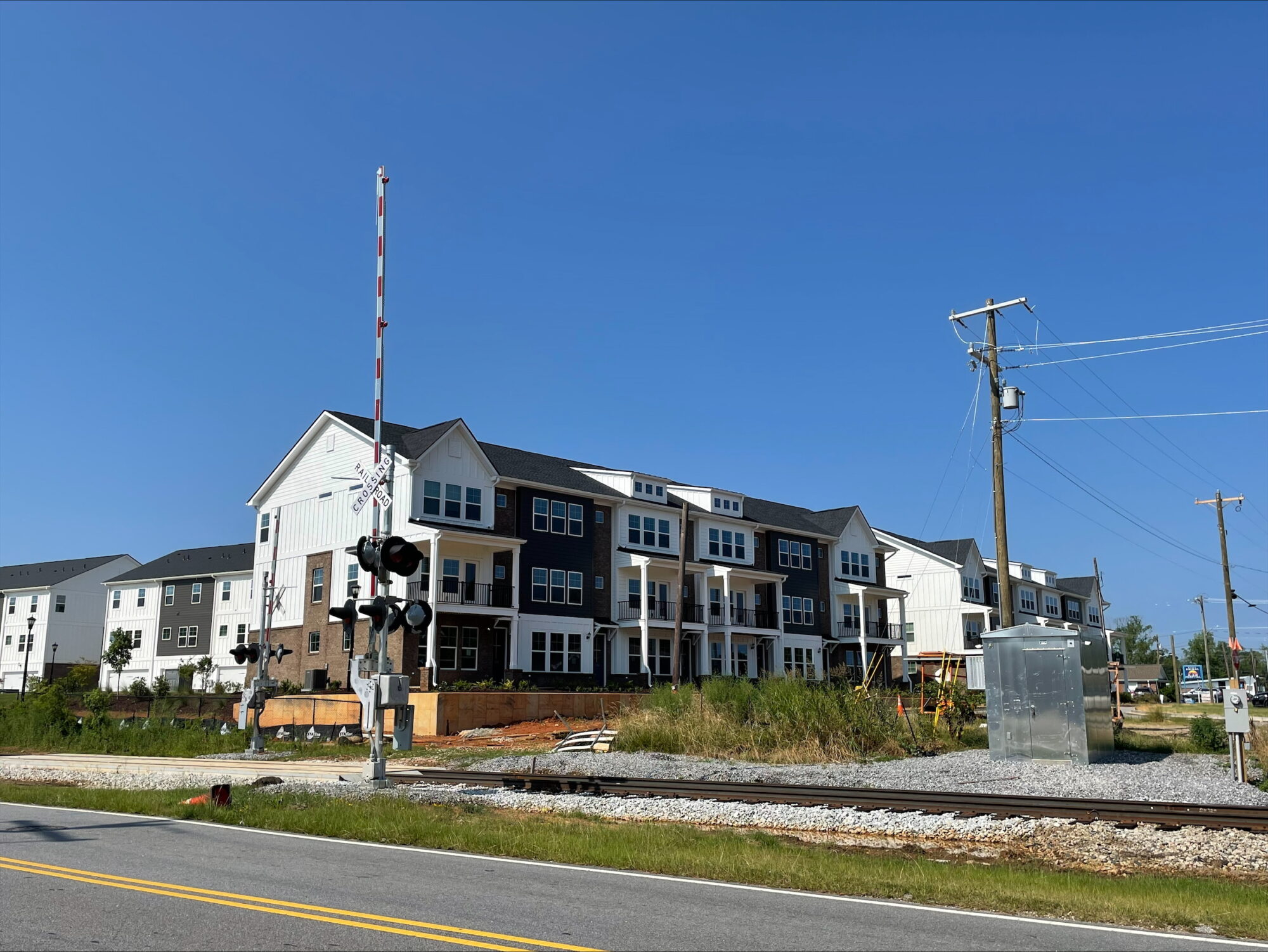
As part of the Maverick Yards development, the City has partnered with CoTransCo and the Greenville Legislative Delegation Transportation Committee (GLDTC) to enhance roadway infrastructure along Jenkins Street, Murray Drive and Main Street.
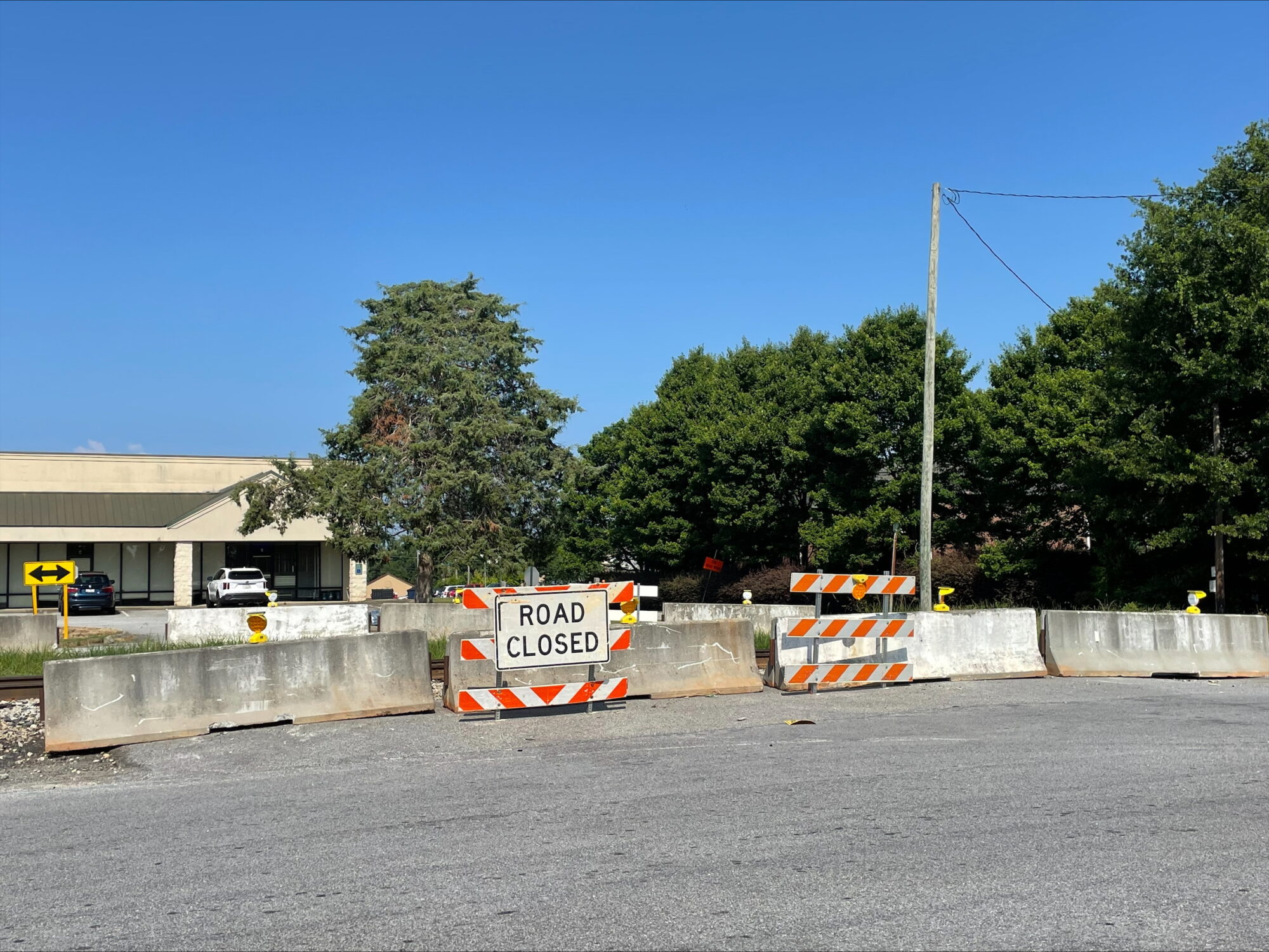
This project extends Jenkins Street across Murray Drive to Hyde Circle, creating a new railroad crossing and 4-way stop sign intersection that will improve traffic flow and enhance pedestrian access and safety.
The project scope includes the following:
- Utility relocations by Piedmont Natural Gas – complete
- Upgraded stormwater infrastructure – complete
- Resurfacing of Jenkins Court – complete
- Resurfacing of Jenkins Street – complete
- Addition of sidewalks – complete
- New railroad crossing signalization – complete
- New intersection at Jenkins Street, Murray Drive and Hyde Circle – complete


Timeline
Roadwork construction began at the end of October, and paving on Jenkins Court was completed in early December.
The project was delayed by frigid temperatures and storms in January, but as of mid-February, paving on Jenkins Street was nearing completion, sidewalks were installed and a pedestrian crosswalk and signals were set to be added to the railroad crossing.
As of March 2, Southern Concrete had received its permit to begin work in the railroad right-of-way and began work on the new crossing on March 4.
As of March 12, resurfacing on Jenkins Street has been completed. Per SCDOT, warning signs about the new four-way stop will be set up this week and must be in place for 2 weeks before the intersection can be opened.
As of March 23, warning signs have been installed, and the intersection at Murray Drive, Jenkins Street and Hyde Circle will be open on April 1 (no, it’s not an April Fools joke!) with a four-way stop in place.
As of April 1, the new intersection and railroad crossing are officially open, and the four-way stop is in place. Members of the Mauldin Police Department’s traffic team will be periodically posted at the intersection over the next couple of weeks to monitor traffic.
We appreciate your patience throughout this process!
Project Overview
Each year, the City of Mauldin partners with the Greenville Legislative Delegation Transportation Committee (GLDTC) through the Municipal Match Resurfacing Program to resurface streets that have deteriorated beyond the point of maintenance and repair.
Through this partnership, projects submitted by the City of Mauldin are matched dollar-for-dollar by the GLDTC and managed by the GLDTC’s program manager.
Prioritization
Street resurfacing and maintenance are evaluated and prioritized based on a third-party analysis of the Pavement Condition Index (PCI) — a numerical grade from 0 to 100 that assesses the condition of pavement based on a survey of its various distresses — as well as street classification, development and utility scheduling, and the available budget approved by City Council.
Based on these factors, roads are selected and approved by City Council for resurfacing. Once approved, the list is provided to the GLDTC’s program manager, who develops the work schedule.
Upcoming Resurfacing Schedule
The following roadways are scheduled for resurfacing:
| Mileage | Street | From | To |
|---|---|---|---|
| 0.03 | Tideland Ct | Marsh Creek Drive | cul-de-sac |
| 0.02 | Bayou Cove | Marsh Creek Drive | cul-de-sac |
| 0.38 | Fieldgate Ct | Planters Row Drive | Woodvine Way |
| 0.09 | Mylon Ray Hopkins Ct | Royal Oak Road | Gilder Creek Drive |
| 0.13 | Pine Straw Way | Gilder Creek Drive | Piney Grove Road |
| 0.25 | Parsons Street | Bon Air Street | Lyle Street |
| 0.23 | Shadecrest Drive | Old Mill | cul-de-sac |
| 0.03 | Calix Ct | Shadecrest Drive | cul-de-sac |
| 0.22 | Huntington Circle | Knollwood Drive | cul-de-sac |
| 0.25 | Meadowood Drive | New Neely Ferry | cul-de-sac |
| 0.15 | Lawnfield Street | Meadowood Drive | Woodgreen Drive |
| 0.25 | Woodgreen Drive | Meadowood Drive | cul-de-sac |
| 0.66 | Knollwood Drive | Chetsworth Lane | Huntington Circle |
| 0.1 | Ellen Lane | Thelma Drive | Pinehurst Drive |
| 0.23 | Lanier Lane | Pinehurst Drive | Owens Lane |
For more information regarding resurfacing on your street, contact the Public Works Department at (864) 289-8904 or mauldinpublicworks@mauldincitysc.com.
Project Overview
The City of Mauldin has partnered with the Greenville Legislative Delegation Transportation Committee (GLDTC) to improve the interchange at Ashmore Bridge Road and Standing Springs Road. The scope of work will include signalization and other intersection improvements to increase safety in that area.
The City contributed $50,000 in funding for this project.
Timeline
Project Manager CoTransCo is currently finalizing needed permits. Construction is estimated to commence in Q1 of 2026 and should to last no more than 12 months from mobilization.
Parks, Trails & Sidewalks
Our parks, trails and sidewalks are vital connections that bring our community together. By improving and expanding these spaces, we’re building a strong foundation for a safe, active and welcoming city.
Project Overview
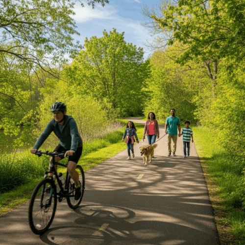
The City of Mauldin is working with SCDOT, Greenville County and the Upstate Greenways and Trails Alliance (UGATA) to extend portions of the Prisma Health Swamp Rabbit Trail (SRT) network, a 28-mile multiuse trail system running through Greenville County.
The Green Line will connect to the City of Greenville’s segment at the Clemson University International Center for Automotive Research (CU-ICAR), run south to Mauldin City Hall and connect to the blue line, which will run to BridgeWay Station via the Mauldin Gateway Bridge.
Portions of the trail network currently installed in Mauldin include:
- Mauldin City Trail & Mauldin Gateway Bridge – This segment runs from E. Butler Rd across from Mauldin High School and crosses over I-385 via the Mauldin Gateway Bridge to BridgeWay Station.
- Maverick Yards – This segment is part of the current mixed-use development along Jenkins Street that includes more than 40 townhomes and a dining and entertainment complex. The SRT will connect at both ends of this segment along Murray Drive, extending north to CU-ICAR and south to City Hall/E. Butler Road.
- Layton Hall Development – This segment was recently installed as part of the Layton Hall Townhome Development. The SRT will connect at both ends of this segment, extending north to CU-ICAR and south to City Hall/E. Butler Road.
Timeline
The City, SCDOT and UGATA are currently in right-of-way discussions along the proposed route. While some segments are already installed, preliminary engineering for the trail from CU-ICAR to E. Butler Road will tentatively begin Spring/Summer 2026.
To see the current proposed route, visit https://ugata.org/interactive-map/
Project Overview
The City of Mauldin received state appropriations and funding through the Greenville Legislative Delegation Transportation Committee (GLDTC) to make safety improvements along a portion of Miller Road. The project scope includes installing approximately 2,700 ft of new sidewalk along Miller Road from Old Mill Road to Loblolly Lane to increase safety for residents walking to and from Mauldin High School.
The City has contracted with CoTransCo to install sidewalk in two sections along Miller Road within the City of Mauldin and parts of unincorporated Greenville County:
- From Old Mill Road to Corn Road, to include a pedestrian bridge over Gilder Creek
- From Middle Road to Loblolly Lane (approximately 1,200 feet)
Timeline
As of mid-October, contractors are working on right-of-way acquisitions and environmental permitting for stormwater for the wetlands and bridge portion of the project. Once complete, the project will go out to bid, with construction estimated to commence in early 2026.
Sewer Infrastructure
Our city’s sewer system is one of the most important — and often overlooked — parts of daily life. To keep our community healthy, protect the environment and prevent costly emergencies, we invest in regular maintenance and upgrades to this critical infrastructure.
Project Overview
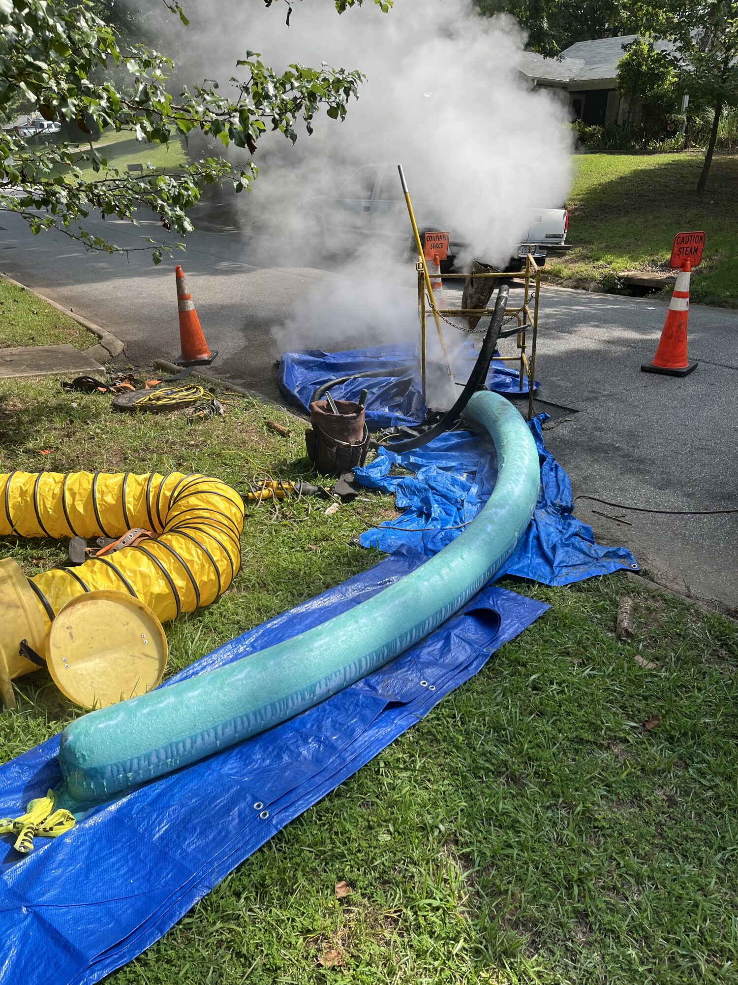
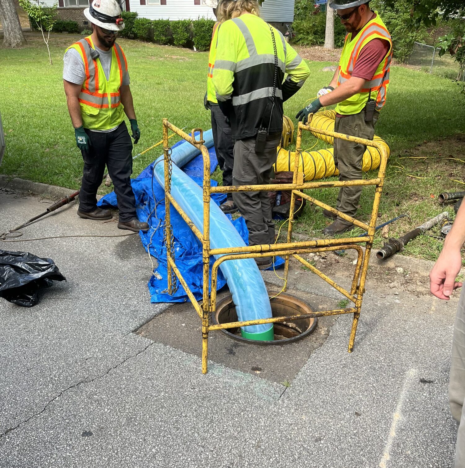
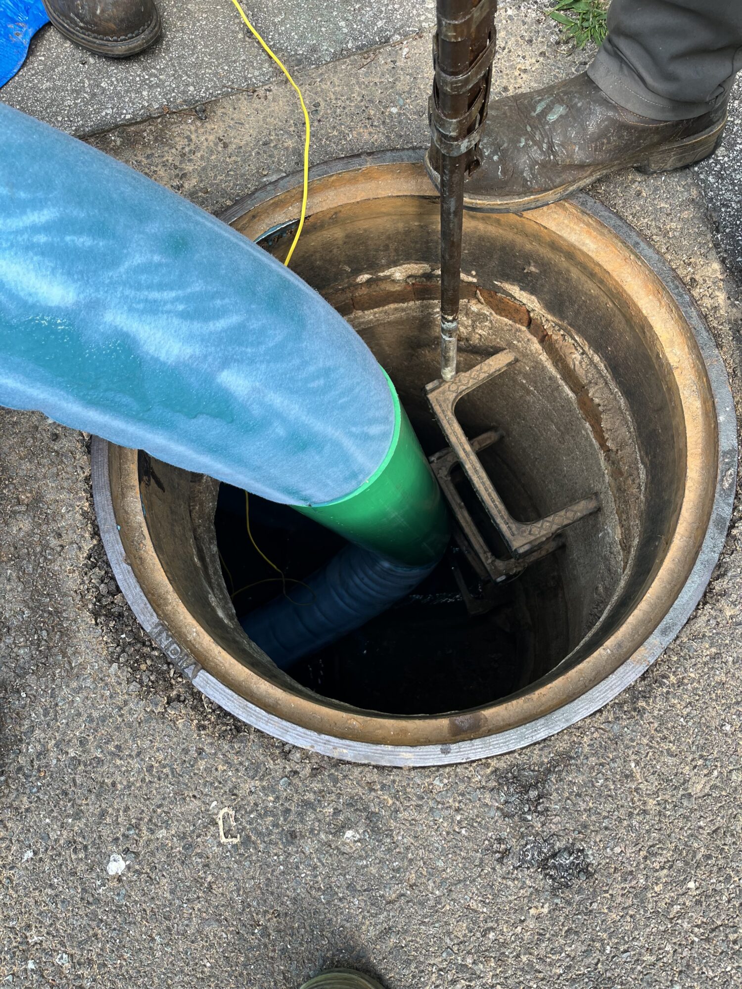
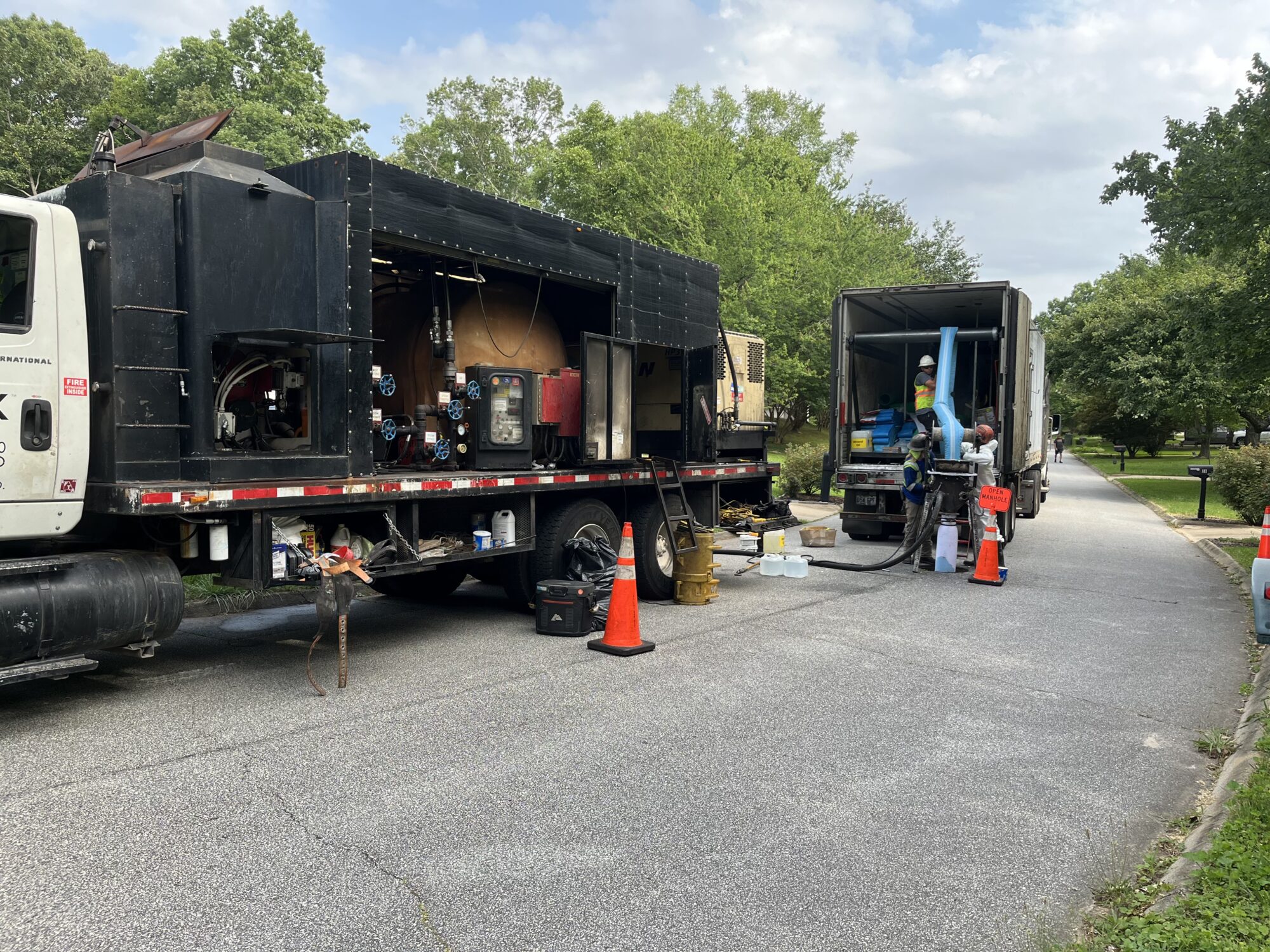
In April of 2023, the City of Mauldin was awarded a nearly $3.4 million grant from the South Carolina Rural Infrastructure Authority (RIA) for a sewer rehabilitation project that allows the City to make critical improvements to its sewer system.
The funds are being used to rehabilitate deteriorating clay sewer pipes that were installed more than 60 years ago. The full scope of the project includes rehabilitation of approximately 12,500 feet of existing clay sewer pipe as well as approximately 73 brick manholes and 120 clay service laterals.


Awarded as part of the South Carolina Infrastructure Investment Program (SCIIP), the $3,399,750 grant is for the city’s Basin RG2 Sanitary Sewer Rehabilitation Project. The City of Mauldin contributed approximately $600,000 in local match for construction and engineering services related to the project.
Officials said the funds will allow the City to continue protecting public health and the environment while preparing for future growth and development.
Timeline
Work began in early 2024 and is expected to be completed by May 2026.
For more information on the project, click here.
Other Projects
Additional projects in the city are listed here.
Project Overview
Laurel Creek is a 11.7-square mile watershed that extends into the City of Greenville, City of Mauldin, and unincorporated Greenville County.
After years of less restricted development and multiple confinements along its reaches (bridges, culverts, sewer lines on either side), this creek has degraded over time, contributing sediment and nutrients downstream to the Reedy River. To prevent further degradation, Greenville County will be working to stabilize the banks along this stream.
This project will restore two tributaries of the lower section of Laurel Creek between the Laurel Meadow and Knollwood neighborhoods. This section is located near the confluence with the Reedy River, downstream of Lake Conestee, and includes approximately 4,000 feet of stream.
View a presentation on the project here.
For more information, visit greenvillecounty.org/LandDevelopment/LaurelCreek.aspx.
Plans
Mauldin’s future is shaped by careful planning and community input. By working together and planning ahead, we can create a thriving city — now and for generations to come.
The City of Mauldin adopted its five-year Strategic Plan in January 2025.
The process to develop the plan included a community-wide survey as well as listening sessions with staff, the community and City Council. The themes that emerged from the process informed the vision and four focus areas:
- High-Quality Services – The City of Mauldin is focused on delivering High-Quality Services that enhance quality of life, build trust with the community, and represent a significant value to taxpayers.
- Vibrant Community – The City of Mauldin is a Vibrant Community with award-winning facilities, programs and services and an emerging hub of cultural and recreational tourism for the region. The City seeks to ensure a dynamic quality of life for residents.
- Strong & Reliable Infrastructure – The City is focused on maintaining and enhancing Strong & Reliable Infrastructure to address current and future needs related to stormwater, public facilities, public utilities, transportation and more.
- Character & Identity – The City of Mauldin is focused on utilizing its best assets to establish a Character & Identity that highlights this community as a place where people want to live, work and play.
Vision Statement: The City of Mauldin envisions a future as a vibrant and sustainable community, where a thriving city center, dynamic cultural and recreational amenities, and livable neighborhoods connect people, cultures, and opportunities.
Click below to view the full plan.
Mauldin City Council is excited to unveil the City Center Master Plan, a vision for the City’s future walkable village in the heart of Mauldin. In partnership with Seamon Whiteside, the City has created a plan to develop and encourage economic development within the urban core that will transform our crossroads community into a vibrant urban village.
The City envisions a walkable downtown with a mix of retail, dining, civic and mixed-use development that will serve as a place of connection, entertainment and modern living.
View the City Center Master Plan below.
The City is currently working on a Comprehensive Plan that will serve as a roadmap for the city’s growth and development. The Comprehensive Plan provides a long-term vision that aligns community aspirations with data-driven strategies and establishes a framework to guide land use decisions. The plan is estimated to completed by late 2025/early 2026.
For more information, visit www.planmauldin.com.
As of September 2025, the City is developing a Parks Master Plan that will shape the future of Mauldin’s parks, programs and facilities.
The plan will identify community priorities, guide future improvements and ensure Mauldin’s recreation system meets the evolving needs of residents. Once completed, the plan will be posted here.